
San Francisco: In a bid to help people navigate safely in the pandemic times, Google has added the Covid layer in Maps that will show critical information about Covid-19 cases in an area people plan to visit in 220 countries.
The Covid layer in Google Maps will start rolling out worldwide on Android and iOS this week.
Data featured in the Covid layer comes from multiple authoritative sources, including Johns Hopkins, the New York Times, and Wikipedia who, in turn, get data from public health organisations like the World Health Organisation, government health ministries, along with state and local health agencies and hospitals.
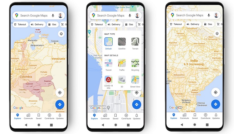
When you open Google Maps, tap on the layers button on the top right hand corner of the screen and click on “Covid-19 info”.
“You’ll then see a seven-day average of new Covid cases per 100,000 people for the area of the map you’re looking at, and a label…